Map Of �Ye Olde Murton' - Murton (murt0148)
Map Of �Ye Olde Murton' - Murton
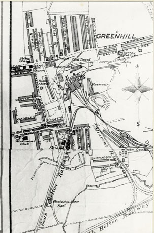
Photograph of a plan of Murton, described as Plan of Ye Olde Murton; the plan appears to be based on a nineteenth century Ordnance Survey plan and shows the colliery and a few streets to the west, north and south; the South Hetton Railway is also shown
Date: 1850 - 1859
Return to search options
The People Past and Present web system is no longer being updated. At the time of publication the information provided was believed to be correct but may contain some factual errors.


